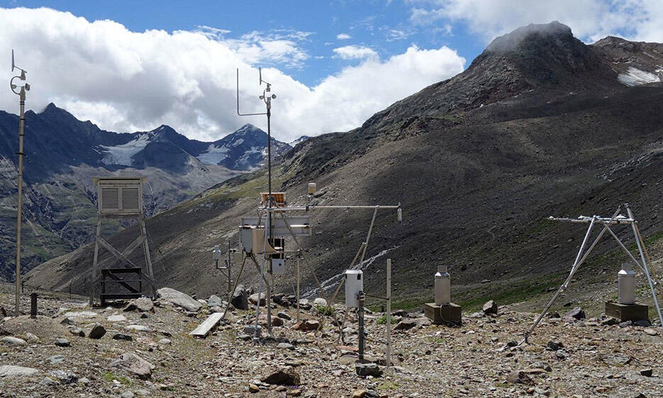
Data is available from a number of automatic weather stations operating in the upper Rofental, as well as from longer term measurement sites, and temporary meteorological installations associated with specific experiments. Most meteorological data will be recorded and updated in the living data repository associated with Earth System Science Data publication on The Rofental: a high Alpine research basin (1890–3770 m a.s.l.) in the Ötztal Alps (Austria) with over 150 years of hydrometeorological and glaciological observations
Totalizing precipitation gauges:
The totalizing rain gauges are operated by the Department of Atmospheric and Cryospheric Sciences of the University of Innsbruck with financial support by the Hydrographic Service of Tyrol. Readings are undertaken every 2 months in summer with a break in winter. These totals are then redistributed to monthly values using data from the weighing rain gauge in Vent.
| Vent | 1900m |
1905 - present |
data |
| Hochjochhospiz | 2360m |
1952 - present |
data |
| Vernagtbrücke | 2600m |
1965 - present |
data |
| Proviantdepot | 2737m |
1952 - present |
data |
| Rofenberg | 2827m |
1952 - present |
data |
| Latschbloder | 2910m |
1965 - present |
data |
| Hintereis station | 2964m |
1952 - present |
data |
| Saykogel | 2990m |
1963 - 1980 |
data |
| Schwarzkögele | 3075m |
1963 - 1977 |
data |
| Guslar | 2920m |
1964 - 1981 |
data |
| Samoar | 2650m | 1966 - 1974 | data |
| Hintereisalm | 2900m | 1965 - 1987 | data |
Further to these totalizing precipitation gauges, in recent years, 5 of the automatic weather stations in the region (see below) have been instrumented with automatic OTT pluviometers.
Automatic weather stations:
The specifications of these automatic weather stations vary, and are detailed in the Earth System Science Data publication on The Rofental: a high Alpine research basin (1890–3770 m a.s.l.) in the Ötztal Alps (Austria) with over 150 years of hydrometeorological and glaciological observations. These data are partially available online, otherwise are available on request via the operating institution.
| Vent |
1907m |
1935 - present |
data (1935-2011) data (2012-2016) data (2016-present) |
Atmospheric and Cryospheric Sciences, Innsbruck |
| Station Hintereis | 3026m | 2010 - present | Atmospheric and Cryospheric Sciences, Innsbruck | |
| Im Hintern Eis |
2017 - present |
data |
Atmospheric and Cryospheric Sciences, Innsbruck | |
| Hintereisferner | 2014 - present | upon request |
Atmospheric and Cryospheric Sciences, Innsbruck | |
| Vernachtbach |
2640m |
1974 - present |
data (2002 - 2012) |
Bavarian Academy of Sciences, Munich Live data feed here |
| Schwartzkögele |
3075m |
1976 - present |
Bavarian Academy of Sciences, Munich | |
| Vernagtferner |
2003 - present |
data (1968 -1987) |
Bavarian Academy of Sciences, Munich | |
| Latschbloder |
2919m |
2013 - present |
data (2013) data (2014) data (2015) data (2016) data (2017) |
Geography, Innsbruck Live data feed here |
| Bella Vista |
2805m |
2015 - present |
data (2015) data (2016) data (2017)
|
Geography, Innsbruck
|
| Teufelsegg |
3035m |
data |
Hydrographic Office of the Civil Protection Agency of the Autonomous Province of Bolzano – South Tyrol |
|
| Grawand |
3220m |
data | Hydrographic Office of the Civil Protection Agency of the Autonomous Province of Bolzano – South Tyrol |
|
| Vernagt | 1950m | data | Hydrographic Office of the Civil Protection Agency of the Autonomous Province of Bolzano – South Tyrol |
Short term projects, dedicated to measuring the surface mass balance of snow and ice on the glacier involved
temporary installations of AWSs on the glaciers of the region:
- Obleitner, F. (1994) Climatological features of glacier and valley winds at the Hintereisferner (Ötztal Alps, Austria), Theoretical and Applied Climatology, 49, 225–239.
Historical data:
In addition to these digital automatic weather station, analogue weather records from the historical terminus of Hintereisferner are held by the Department of Atmospheric and Cryospheric Sciences, Innsbruck.
